Living· CityMETER · Thailand and Cambodia · historical NASA satellite example
Thailand and Cambodia: a hotspot story begins with its date
Fire MonitoringA NASA VIIRS image from 26 February 2016 shows numerous fire signatures across Thailand and Cambodia. This historical example offers a starting point for reading hotspot maps: identify the place and detection time, then follow the information relevant to that area.
Illustration for this story
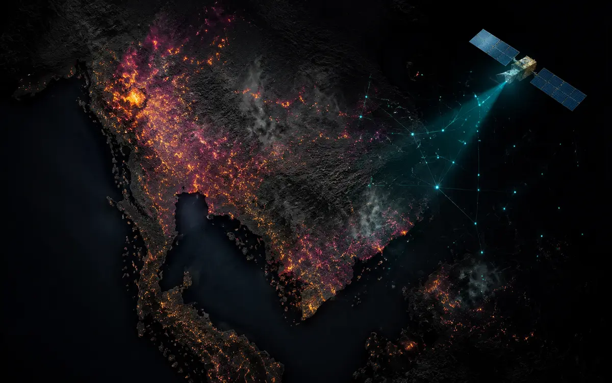
External NASA context · image: 26 February 2016 · published: 29 February 2016 · separate from the selected CityMETER result.
- Data period
- Read the details in sources
- Coverage
- Read the details in sources
- Level of detail
- Satellite hotspots within the selected period
- Publisher
- NASA VIIRS / FIRMS
A historical image makes the time question clear
The NASA example makes the importance of keeping an image with its date easy to grasp. A dated record gives a reader a period to investigate and a place in a timeline. Carry that habit into a hotspot-map enquiry: choose the period being studied, identify the area of interest and keep both together in the working note. Another person can then follow the same starting point and look for reports that relate to that period.
Choose an area connected to the work
A team gathering area information might begin with a community, a managed site or a place involved in its coordination work. With the location defined, read the detections displayed for the selected period and note the points to investigate further. A specific enquiry turns a broad view into a manageable set of questions. Which organisation published information during that period? Does its report refer to the same location? The work can proceed from identifiable places and times, giving every request for information a clear reason.
Build a timeline around the location
Arrange detection times and relevant reports in a timeline, keeping the source of each item visible in the working material. If field information becomes available, record its time and location separately from the satellite record. This organisation helps a team see which questions have supporting material and which need further information. It also makes the enquiry durable. Someone returning later can understand the sequence without relying on the memory of the person who first opened the map, and can add a new item without obscuring the earlier record.
Give a shared image a clear purpose
Before sharing a map, write one sentence naming the area, the period and the question being studied, and include the source that the recipient can open. A clear question helps them respond or direct the enquiry to someone better placed to answer it. For a team collecting information across several areas, this gives each image a distinct purpose. The work moves from a remote view to a local enquiry in a sequence that others can follow, with the location, time and next information need kept together.
Explore your own place
Choose an area and period to study, then keep the detection time with the local reports to read alongside it.
Sources and reading notesPublisher, period, coverage and references
Specialist source
- Data publisher
- NASA VIIRS / FIRMS
- Source
- References VIIRS satellite hotspot detections through NASA FIRMS. Read the satellite detection time with each result.
- Data period
- Period not confirmed — check the reference date in the data view before use.
- Coverage
- Geographic coverage is not stated on the public page
- Level of detail
- Satellite hotspot detections within the selected period
Read the references
Further notes for comparison or citation
VIIRS/FIRMS hotspots are not all fire incidents, burned area or PM2.5 readings, and they are not evacuation guidance.
Hotspots are satellite detections, not every wildfire, burned area or PM2.5 measurement. Read detection time and check field reports.